The depth band runs from 15 to 300 m. Typical size is 150 cm, the largest 230 cm, and the heaviest 103 kg. A band 285 m deep is about 124 times the length of the largest fish in it, and the spawning table puts four separate windows at four different latitudes. The band is not one address. It is a strip that the fish and the season move along.
A band 285 metres deep
FishBase gives 15–300 m with no "usually" figure. That matters: the source ranks neither end. Every metre in the range is equally supported, which is not the same as saying the fish is equally likely at 15 m and at 300 m.
Typical size is 150 cm. That is the number to rig for, and it is large enough that the band cannot be worked with one lure box or one rod. The 285 m span and the 150 cm fish are the two dimensions of the problem.
The 15-metre edge
Fifteen metres is shallow enough to sit inside the habitat keywords: estuary, coastal and continental shelf. The environment line also says brackish and benthopelagic, and the animal qualifies as oceanodromous.
So a small boat can work the shallow end, and some shores put it within reach. This is also the stretch where a 150 cm specimen is likelier to be seen than merely hooked. Nothing in the source gives 15 m a preference; it only places 15 m inside the range.
The 300-metre edge
The deep end is 300 m, and there is no working range to shorten it. A 150 cm fish at 300 m is a boat fish on bottom gear, not a lure cast into the surf. Nothing in the record gives a separate deep-water size distribution, so the same 150 cm figure has to cover both ends.
That is the honest reading: the band is wide, the fish is big, and the source does not tell you where inside the band the bulk sits. A sounder and a temperature profile will answer faster than the page can.
Four spawning records, four latitudes
The spawning table has four rows. Bay of Biscay: May to July. Canaries: January to May. Mauritania: January to May. Tunisia: April to July. The two southern rows start four months earlier than the Biscay row, and Tunisia sits in the Mediterranean rather than the Atlantic.
This is the clearest structure in the record. A single species, one band, four calendars arranged by latitude. The table does not give spawning depth, so the calendar cannot be turned into a depth instruction; it only says when, not where in the 285 m.
Where the distribution records sit
GBIF's 13 distribution assertions are concentrated in the northeast Atlantic and the Mediterranean: Belgium, Spain, Greece, Israel, Norway (2) and Sweden (2), with the Black Sea, the Donana Biosphere Reserve and the Israeli eastern Mediterranean as named localities. The Black Sea assertion names a locality but carries no depth.
There is no West African assertion in the set, even though Mauritania appears in the spawning table. That is a gap between two sources, not evidence that the fish is absent there. It does mean the southern spawning row has no distribution record behind it on this page, and a trip built on that row is running on one source only.
150 cm is the common fish
The largest fish reaches 230 cm and 103 kg, while the ordinary one measures 150 cm. Two-thirds of the record length is the ordinary fish, which is unusual in this batch and useful at the rail: the leader, the net and the release plan should be sized for 150, not for 230.
Maturity is not given, and neither is maximum age. This source therefore supplies no release cut-off, only a spread of sizes. The 103 kg figure is a maximum weight without a paired length, so it must not be turned into "a 230 cm fish weighs 103 kg".
Meagre, corvina
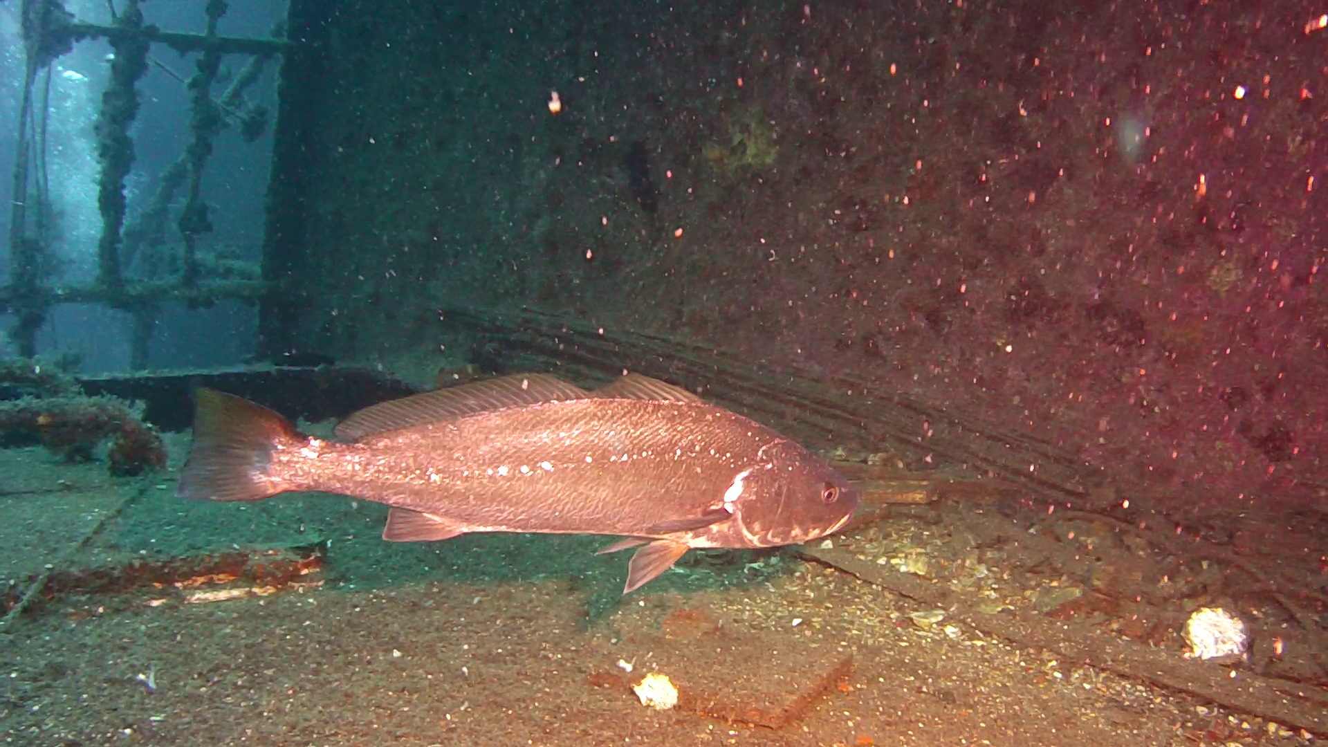
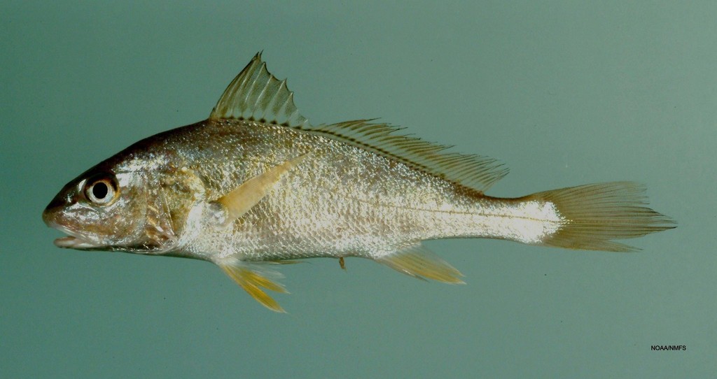
Wikipedia lists the market names: meagre, croaker, jewfish, shade-fish, sowa, kir, corvina, salmon-bass and stone bass. It also describes the fish as pearly-silver with a yellow mouth, which is more useful for identification at the boat than most of the names.
In Chinese, FishBase gives ; the expansion list carries , and appears on the common-name table. iNaturalist carries 134 observations under the taxon. The names split by language and by market, but the binomial does not.
Reading the band on the day
Use the four spawning rows as a latitude calendar, not as a depth map: Biscay in early summer, the Canaries and Mauritania from January, Tunisia from April. Begin on the shallow third of the band: a small boat covers that ground, and the habitat keywords describe it. Move deeper only when the sounder shows fish or structure worth the drop.
The band is 285 m deep and the record does not rank it. One drop is a sample, not a survey. The GBIF distribution set adds the northeast Atlantic and Mediterranean weighting, and its silence on West Africa is a gap to carry, not a conclusion.
Regulations before you keep it
These are the published regulations for this fish. Read the number first. The notice below it is the actual regulation.
Minimum size3
The minimum size for Meagre in France is ≥50 cm.
| MAIGRE | Argyrosomus regius | 50 cm |
The minimum size for Meagre in France is ≥45 cm.
| MAIGRE | Argyrosomus regius | 45 cm |
The minimum size for Meagre in Portugal is ≥42 cm.
Corvina-legítima (Argyrosomus regius) | 42 cm
Every record above names its source and the date it was retrieved. See the regulation register for the full list, or how to read these regulations.
Where these facts come from
Check these pages before you rely on a size, range or protection status.
-
FishBase — Argyrosomus regius
— FishBase · T2
-
GBIF — Argyrosomus regius occurrence records
— GBIF · T2
-
IUCN Red List — Argyrosomus regius
— IUCN · T1
-
Photo record — iNaturalist
— iNaturalist · T3