
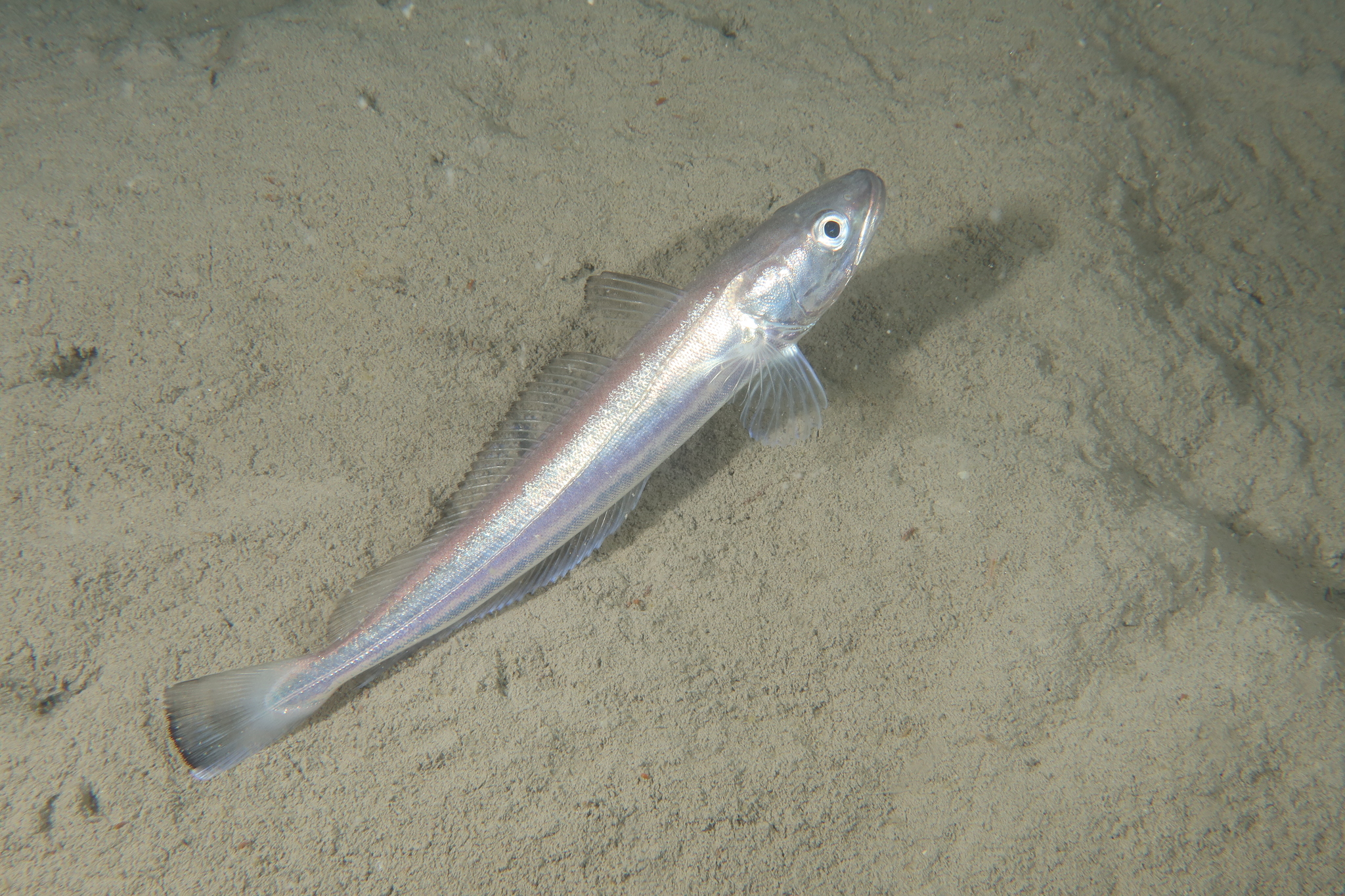
Shallow-water Cape hake
Fisheries paperwork for this fish asks for a weight and an age. The account supplies neither, and it also declines to name one water type, one sea region. What is filled is specific enough to work from: 140 cm TL maximum, 50 cm TL routine, 50–1000 m, and a coastline running through three countries. The blanks are treated here as instructions for the drop.

Fisheries paperwork for this fish asks for a weight and an age. The account supplies neither, and it also declines to name one water type, one sea region. What is filled is specific enough to work from: 140 cm TL maximum, 50 cm TL routine, 50–1000 m, and a coastline running through three countries. The blanks are treated here as instructions for the drop.
The cells a skipper reaches for first
FishBase's account for Merluccius capensis (ID 1828) leaves the maximum weight and the maximum age cells unfilled. The environment line gives depth as 50–1000 m, with 150–450 m called usual, and carries the tag string "Marine; bathydemersal; oceanodromous"; the field meant to hold one milieu value stays blank. The sea_region list in the page header is blank too, so the sea is not something the record hands over — it has to be assembled from the country list and the depth box.
Each blank governs a decision on deck: how much lead a fish is worth, how old a stock is, which part of the column to fish, which coast to sail from. None of them can be settled by a figure that was never written. The page instead offers a spine — 47.4 cm first maturity, 42–54 dorsal soft rays, 37–41 anal soft rays, and a Valdivia Bank record at 26°18'S, 6°20'E — which is enough to place the fish without inventing the missing cells.
A blank is not an invitation to borrow
The easy move is to take the missing weight and age from the deep-water Cape hake, which the same summary describes as similar in appearance. The trade names make the borrowing hard to audit: "hake" covers both Cape species, and a landing slip written that way cannot be traced back to one of them. A borrowed figure filed under this species would be indistinguishable from a figure that belonged to it, so the blanks stay blank. What pins the fish is its own accepted record: Merluccius capensis Castelnau, 1861, marine only, on the WoRMS register.
Fifty to one thousand metres is the only filled interval
Depth is the one axis the page completes. The overall range is 50–1000 m and the usual range 150–450 m; the environment line fixes a box of 11°S–37°S by 5°E–33°E, with the climate word "Deep-water" and no Celsius figure anywhere.
That leaves 1000 m as the outer end of the record and 450 m as the outer edge of the usual band. A drop can start at 150 m, step outward, and stop at 450 m without leaving documented water. Wikipedia's daytime ceiling of 400 m falls inside the same band, so observation and record overlap rather than compete.
Depth sets the drop, not the bottom. The page files this fish on the shelf edge rather than on flat sand, and that difference decides the rig: on an incline the lead has to grip, or the bait keeps rolling downslope and the line lies at the wrong angle. A plain ball weight on a slack line will not hold at 300 m; a spreader or a heavy jig head that bites into the incline will. Its stomach contents are crustaceans and fishes, so a strip of baitfish on a two-hook rig matches the recorded diet better than a soft worm that washes out on the retrieve.
Day on the bottom, night in the water
Wikipedia gives the daily movement: by day the fish stays close to the bottom on the continental shelf and upper slope, usually not deeper than 400 m; at night it rises through the water column to feed. The same summary adds a drift south in spring and north in autumn.
For a boat the day splits in two. A bait on the bottom at midday is offered to a resting fish; the same bait lifted clear of the bottom after dark is offered to a feeding one. The seasonal line adds a second decision: follow the coast south in spring and north in autumn, not one mark for all year. The 400 m daytime ceiling sits inside the 150–450 m usual band, so a midday drop near 300 m is inside both statements at once.
A 140-centimetre record and a 50-centimetre routine
The size block pairs a 140 cm TL maximum with a 50 cm TL common length and puts first maturity at 47.4 cm. The maturity figure is the only one that changes behaviour on deck: anything under 47.4 cm is unspawned and goes back; anything over it belongs to the breeding stock, and Angola, Namibia or South Africa sets the rule. The routine 50 cm fish sits barely past the line, which is why "small" and "breeding" overlap here.
Length is the only size measure the record completes. There is no maximum weight cell and no age cell, so no growth curve can be drawn on this page and no age class should be written on the tag. The action is narrow: carry a measuring board, log total length, and leave the age box blank rather than guess at it.
Spawning records name grounds, not depths
The spawning table holds two rows. One reads "Lüderitz (Namibia) and Cape fishing grounds, 1970", August to November. The other reads "southern Africa" with all twelve months marked. The second cancels the first as a calendar: a record covering January through December cannot tell a skipper which month to book. What survives is the pair of grounds and a four-month window tied to 1970.
Neither row carries a spawning depth or a spawning temperature. That blank is the reason not to read the August–November window as a shallow-water signal. Lüderitz and the Cape grounds lie inside the three-country list — Angola, Namibia, South Africa — and their depth comes from the 150–450 m band, not the spawning line.
Where the regional labels come from
GBIF's distribution record for this species is assembled from checklists rather than from a survey. ITIS contributes "Eastern Atlantic Ocean" and "Indo-West Pacific"; IUCN contributes a single "Global" row marked Least Concern, the same assessment FishBase dates to 12 July 2012; WoRMS contributes "Atlantic, Southeast", "Indian Ocean, Western", "Southern Africa" and "South Africa". A string such as "Indo-West Pacific" is therefore a checklist's ocean division rather than a stretch of coastline someone fished.
Two of those do not sit together: the ITIS "Indo-West Pacific" declaration and FishBase's "Southeast Atlantic: Baie Farte, Angola around Cape to Natal, South Africa". The page holds both; so does this article. The IUCN row is a scope rather than a range limit; WoRMS gives marine-region names, not ports.
iNaturalist holds ten observations of this species. Photographs scattered along the coast from Angola to Natal confirm the fish is there; they do not locate a mark.
The order of work the blanks produce
The blanks can be turned into an order of work. First, choose the coast from the country list — Angola, Namibia, South Africa — with the GBIF "Southern Africa" and "South Africa" rows agreeing at the southern end. Second, set the first drop inside 150–450 m, from the inner edge to 450. Third, read the ground from the shelf edge rather than the flat, and rig the lead to grip it. Fourth, choose the hour — bottom by day, clear of it after dark. Fifth, measure length only, send back anything under 47.4 cm, and record no age class.
That is what the unfilled cells yield: a search order built from filled columns, with no dependence on numbers that were never there.
Where these facts come from
Check these pages before you rely on a size, range or protection status.
- FishBase — Merluccius capensis — FishBase · T2
- GBIF — Merluccius capensis occurrence records — GBIF · T2
- IUCN Red List — Merluccius capensis — IUCN · T1
- Photo record — iNaturalist — iNaturalist · T3
Fish in the same water
These fish live in the same place.

Deep-water Cape hake
- Family
- Merlucciidae
- Depth
- 200–1000 m
European hake
- Family
- Merlucciidae
- Depth
- 18–1075 m
- Season
- Jan, Feb, Mar, Apr, May, Jun, Jul, Aug, Sep, Oct, Nov, Dec

Silver hake
- Family
- Merlucciidae
- Depth
- 55–914 m
- Season
- May, Jun, Jul, Aug, Sep, Oct
Guides for this water
Technique, gear and safety guides that fit Shallow-water Cape hake.