FishBase puts this species inside a temperate envelope: 5°C to 20°C, 10°S to 60°S. Two lines further down, its spawning grounds are listed between 7°S and 20°S, south of Java, and in the tropical eastern Indian Ocean. Both statements belong to the same record, and neither is a typing error. The first is a climate class applied to the whole page; the second is a list of dated observations. Read as one claim, they describe a fish that spawns below its own temperature floor. This article keeps the two apart instead of choosing a winner.
The label and the diary
The environment line is a summary written once and reused: marine, pelagic-oceanic, oceanodromous, 0 to 2,743 m, Temperate, 5–20°C. The spawning table is a different kind of object. It has months and places. January to June and August to December, northeastern Indian Ocean south of Java, between 7°S and 20°S; the same months again, tagged to Indonesia, tropical eastern Indian Ocean. July is the only month missing. Eleven months at two tropical localities is not a stray note; it is the most specific biological statement on the page.
A climate class and a spawning table measure different things. The first says which band of water the species is usually reported from. The second says where somebody once found ripe fish. When they disagree, the table is the harder record, because it carries coordinates and dates, while the temperature tag is a wide label applied to a whole ocean.
What the tropical list implies
The distribution text is not neutral either. It places the species mainly between 30°S and 50°S, to nearly 60°S, then adds that large fish migrate to tropical seas off the west coast of Australia, up to 10°S, in order to spawn. So the text already contains both halves of the contradiction: a cold feeding range and a warm spawning range. The table supplies the localities that the text describes only in general terms.
Read that way, the word Temperate is not wrong. It describes the feeding range, where most of the fish spend most of their lives. What it fails to describe is the part a season planner cares about. An animal that moves from 40°S to 10°S is not one climate; it is two, joined by a migration.
Three conservation labels, one decision
The page carries three status fields. IUCN: Endangered, assessed 15 January 2021. CITES: Not Evaluated. CMS: Not Evaluated. Only the first has a category. The other two record that no listing assessment appears on this page, which is a blank rather than a clearance. Reading Not Evaluated as unregulated would be as wrong as reading Endangered as a ban on angling.
The human-use line adds a fourth signal: commercial fisheries, commercial aquaculture, gamefish yes. A species can be endangered as a wild spawning stock and still appear at a farm gate and on a charter boat. The record describes neither the farming method, the origin of the farmed stock, nor the quota arrangement behind the commercial fishery.
An Endangered assessment of a highly migratory species is a statement about a shared stock, not a local abundance count. No catch limit, allocation or country-level quota appears in the record. To learn whether a trip is legal, a reader has to leave this page and consult the management body.
Fourteen territories, one heavy count
FishBase lists fourteen territories, from Argentina and Brazil through South Africa and Madagascar to Australia and New Zealand, plus several southern island groups. Of its 2,451 GBIF records, 2,201 are Australian; New Zealand contributes 51, Canada 43, France 26, and the rest is scatter.
The mismatch is instructive. A distribution list records where reports came from; an occurrence index says where specimens have been catalogued. For a fish heavily sampled by one national programme, those two maps will never match. The Australian weight does not shrink the range, and the fourteen-name list does not prove a resident population in every territory.
For planning, the useful reading is narrower: a southern-hemisphere animal, catalogued mostly in Australian waters, with the other entries as range edges or island records.
A depth range with no middle
The depth field runs from the surface to 2,743 m and gives no usual band. That figure is a tolerance, not a target. A pelagic fish recorded at hadal depth somewhere in its range says almost nothing about where to set a lure. No preferred temperature is given either.
What the page does support is a surface fishery. The approved methods are trolling and vertical jigging, both worked from a moving boat, and its habitat is tagged open-water. Start at the top: find temperature breaks and current edges, then let the sounder show how deep the school is sitting. The 2,743 m entry should never become a fishing depth.
The size ladder
Maximum length is 245 cm fork length, maximum published weight 260 kg, and the oldest specimen on record is 20 years. The common length is 160 cm fork length. Maturity is listed at 122 cm, range 120–130 cm. The only meristic entry is 39 vertebrae; no fin-ray counts are given.
The interesting number is the common length. At 160 cm it sits well above the 122 cm maturity mark, so a fish of the usual size here has already matured. That fits the management story: the commercial and game fisheries target the adult cohort, the same cohort that migrates to the tropical spawning grounds. A 160 cm specimen is not a lucky big one; by this page's own numbers it is the standard unit.
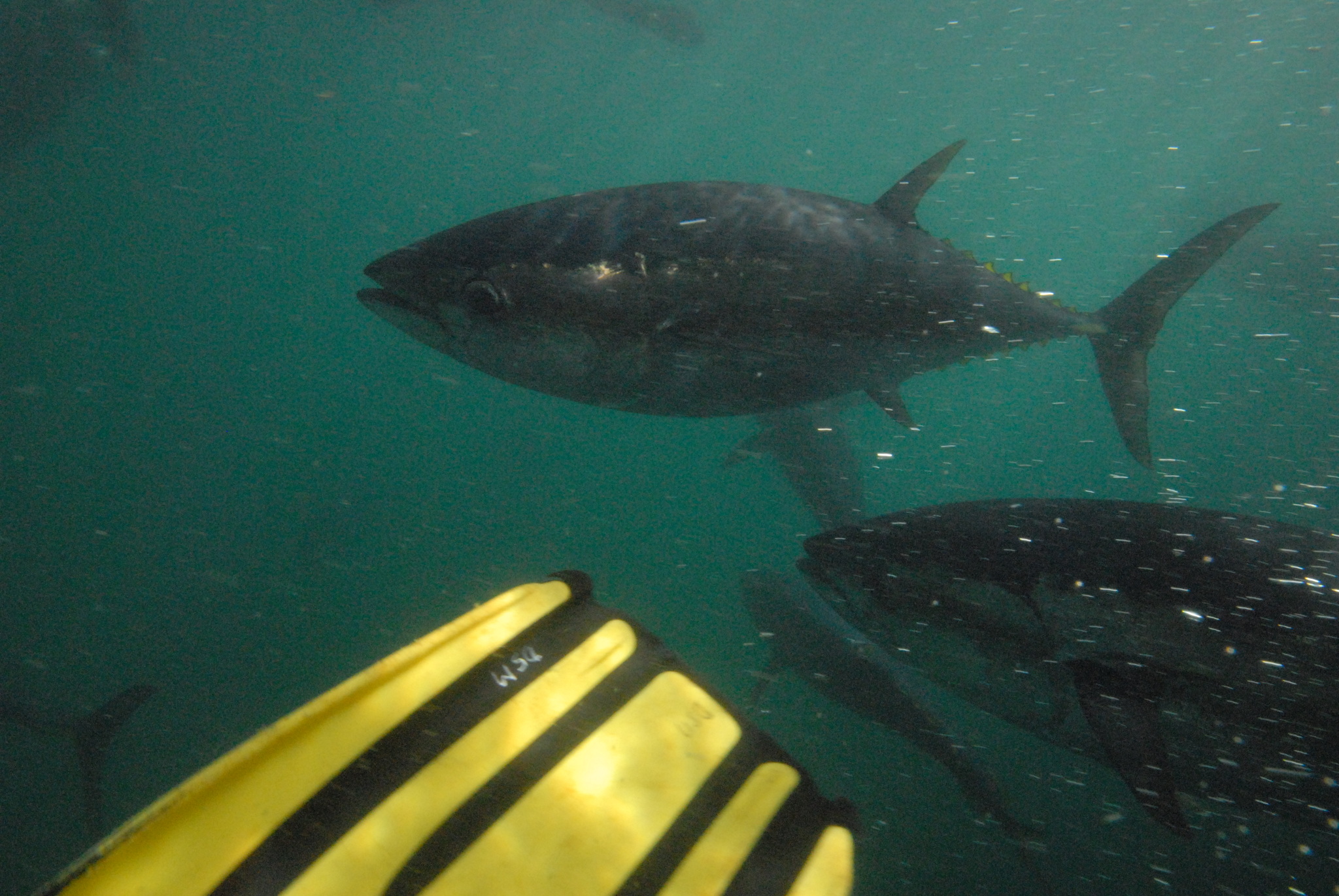
Wikipedia's entry gives its own version of the ladder: up to 2.5 m and 260 kg, among the larger bony fishes, in open water mainly between 30°S and 50°S. The weight agrees with FishBase; the length is recorded a few centimetres longer, so even the ceiling has two published values.
Standing on one side without dismissing the other
The working assumption used here: the temperate band is the feeding range, the tropical localities are the spawning range, and the season is set by the migration between the two rather than by local water temperature. That assumption uses both labels and privileges neither. It also explains why a temperature tag can be accurate and still useless for planning a week.
Two cautions follow. The spawning table is a list of studies, not a survey of the whole ocean, and two tropical localities cannot prove that every southern bluefin spawns in the Indian Ocean. The Endangered category is a 2021 assessment of the global stock, and it says nothing about the legal size, bag limit or season on a particular coast. Use the page to understand the animal, then use a local authority to understand the trip.
Testing the assumption
The observation record is thin. iNaturalist holds 43 observations for the taxon, against 2,451 museum-style records in GBIF. That ratio says more about sampling than abundance: this is a boat fish, photographed rarely and catalogued often by agencies.
One trip is enough to test the assumption. If the fish you meet are mostly large, at or above the 120–130 cm maturity range, you are likely inside the adult cohort and on the spawning side of the migration. If they are smaller and mixed, you are on the feeding range. Record water temperature and size structure together; that pair is the only local evidence that tells you which label you are standing in.
The page never resolves its two labels. It shows which one has dates attached.
How to catch it
Trolling
Trolled from a moving boat; suits roaming or pelagic species.
Jigging
Vertical jigging over the recorded depth range.
Regulations before you keep it
These are the published regulations for this fish. Read the number first. The notice below it is the actual regulation.
Bag limit2
2 fish per person per day · boat limit 6 with 3 or more people aboard
Australia — South Australia · AU-SA
South Australia allows 2 southern bluefin tuna per person per day, with a boat limit of 6 when three or more people are aboard.
With one or two anglers the personal limit governs, so two anglers may keep four fish.
Southern Bluefin Tuna | – | 2 | 6
1 fish per fisher per day
New Zealand — South East · NZ-SE
New Zealand allows 1 southern bluefin tuna per fisher per day.
Southern bluefin tuna | 1 | — | 100
Every record above names its source and the date it was retrieved. See the regulation register for the full list, or how to read these regulations.
Where these facts come from
Check these pages before you rely on a size, range or protection status.
-
FishBase — Thunnus maccoyii
— FishBase · T2
-
GBIF — Thunnus maccoyii occurrence records
— GBIF · T2
-
IUCN Red List — Thunnus maccoyii
— IUCN · T1
-
Photo record — iNaturalist
— iNaturalist · T3