
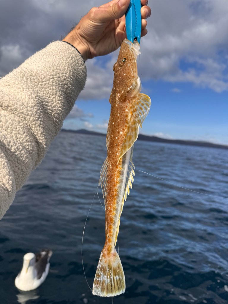
Bartail flathead
Bartail flathead is a bottom-hugging flathead of the Indo-West Pacific, lying on sand and mud in estuaries and along the coast. It reaches 100 cm TL and 3.5 kg and is worked between 20 and 200 m in subtropical water. The season covers most of the year, with June the one month missing. Sources even disagree about whether it enters fresh water: one field says no, another lists freshwater as a habitat keyword.

The FishBase page for Platycephalus indicus contradicts itself about freshwater in two adjacent fields: the environment line sets freshwater to false while the habitat keyword row lists freshwater as a keyword. Both are machine-readable, both belong to the same species, and a filter built on either one alone will file the bartail flathead under the wrong label. This page keeps the disagreement visible instead of picking the tidier half.
Freshwater, true and false on one page
The environment box is explicit in one direction: marine true, brackish true, freshwater false, reef-associated, oceanodromous, depth 20–200 m, range 32°N–35°S and 18°E–157°E. The keyword row is explicit in the other: sandy, muddy, estuary, coastal, freshwater. Estuary and coastal explain how a marine fish can also be called brackish; they do not produce fresh water. The GBIF distribution table supplies a third trail: four of its 49 rows come from the Freshwater Animal Diversity Assessment, covering Afrotropical, Australasian, Oriental and Palaearctic regions. A checklist for freshwater animals does not carry four rows for a fish that never enters it. WoRMS repeats marine and brackish and sets freshwater to false, so the keyword is not a keystroke.
Which line counts as the hard record
Soft labels come from text and checklists. A hard record carries a date, a gear, a depth, a substrate and an accession number. The distribution rows hold one: on 12 December 2011 a flathead was taken by a trammel net north of Beirut, the net set on muddy bottom at about 40 m, and the fish was accessioned as AUBM OS 3780 at 267.5 mm standard length and 263 g. That row fixes marine, muddy and mid-shelf, and no freshwater row in the same table offers a comparable voucher. The meristics add a cross-check: 9–10 dorsal spines and 13 anal soft rays. The name layer repeats the pattern: a landing recorded under a market name such as stays unattributable unless the binomial travels with it. Being harder does not make it the verdict: a marine voucher cannot rule out an estuarine phase, only outrank an unsupported claim.
Twenty metres, two hundred metres, 45.7 centimetres
The depth line is 20–200 m by reference 36128, with no separate usual-depth band. The Beirut specimen at roughly 40 m sits inside it. First maturity is given as Lm 45.7 cm, with no range attached. The 20 m floor is the quiet conflict: an estuary is normally shallower than that, so the box that calls the fish brackish excludes, by its own numbers, the shallowest part of an estuary. Either 20 m describes the trawlable part of the range, or estuary points at water the depth range misses. Both lines are printed and neither annotated, so the reader holds a floor and a habitat that disagree.
Lengths from different papers do not make a curve
The size box holds 100 cm TL maximum from reference 7050, 60 cm TL common from reference 3476, and 45.7 cm at first maturity from the Lm line. They do not form a growth curve: each came from a different reference and probably a different set of fish. At 45.7 cm the fish is already well past halfway to the 60 cm routine size, which makes first maturity a late event rather than an early one. The 3.5 kg maximum weight carries a fourth reference, 40637. The support is narrow: the maximum length and the maximum weight were never measured on the same individual, so "100 cm and 3.5 kg" describes two records, not one animal.
Native rows and introduced rows in one table
The register behind the bartail flathead's distribution rows is mixed: 29 rows come from WoRMS, 8 from WRiMS, 4 from the freshwater assessment, 3 from DAISIE, 4 from national registers, and one from IUCN. Twenty-three rows carry INTRODUCED and three carry RARE, all three from DAISIE; no row carries a DOUBTFUL status, and one WoRMS row places the fish in European Marine Waters without an introduced flag. The introduced dates run from 1902 to a 2021 Abu Qir Harbour record, with the 2011 Lebanese voucher the hardest item in that group. FishBase's country table flags entries as introduced alongside native ones, and its distribution sentence holds both halves at once: Indo-West Pacific, then "Introduced into the eastern Mediterranean Sea". The Suez Canal route is the standard explanation; the table never asks anyone to notice which row is which kind.
A Data Deficient verdict from 2009
The Red List entry is DD, assessed on 4 February 2009. It stands unrevised on the page, and the category itself declines to place the species anywhere on an abundance scale. That removes both readings people reach for: DD is not evidence that the stock is healthy, and it is not evidence that it is scarce. The record base is not empty — 273 iNaturalist observations and 49 distribution rows — but records of presence measure observer effort as much as fish numbers. Nor should the commercial, aquaculture and gamefish entries in the human-uses row be read as a population signal; they describe demand and market, not abundance.
Natal and Hong Kong do not share a season
Spawning records sit in two places: Natal, July to November, and Hong Kong SAR's Tolo Harbour and Lantau Island, January to May and again October to December. June appears in neither record, which is why the merged month list omits it. Natal's block runs from austral winter into spring; Hong Kong SAR's two blocks cover the northern cool season and the start of the warm one. Read as one season, the table says nearly all year, which is useless. Read as two places, each block is a local calendar. No temperature figure accompanies either record in the source data, so there is no common currency for comparing the two sites.
A working hypothesis that picks neither side
Assume P. indicus is a marine and brackish bottom fish of sandy or muddy ground between 20 and 200 m, and that any freshwater label stays unverified until a lot number appears. Verification is concrete: ask the freshwater assessment rows for a specimen or a locality rather than a checklist entry; read establishmentMeans row by row before counting a country as native; check the Red List assessment date before repeating DD as a current statement. For a trip, the hypothesis points at bottom-contact presentations on sand and mud inside the depth band, and treats the eastern Mediterranean rows as an introduction rather than a destination. What would overturn it: a freshwater lot with coordinates and a date.
Where these facts come from
Check these pages before you rely on a size, range or protection status.
- FishBase — Platycephalus indicus — FishBase · T2
- GBIF — Platycephalus indicus occurrence records — GBIF · T2
- IUCN Red List — Platycephalus indicus — IUCN · T1
- Photo record — iNaturalist — iNaturalist · T3
Fish in the same water
These fish live in the same place.

Dusky flathead
- Family
- Platycephalidae
- Depth
- 0–30 m
- Season
- Jan, Feb, Mar, Sep, Oct, Nov, Dec

Sand flathead
- Family
- Platycephalidae
- Depth
- 1–100 m
- Season
- Aug, Sep, Oct
Tiger flathead
- Family
- Platycephalidae
- Depth
- 10–400 m
- Season
- Jan, Feb, Mar, Apr, May, Oct, Nov, Dec
Guides for this water
Technique, gear and safety guides that fit Bartail flathead.