
Crescent grunter
Crescent grunter is an Indo-Pacific euryhaline terapontid, from the Red Sea and East Africa to Samoa, north to southern Japan and south to the Arafura Sea, Australia and Lord Howe Island. It lives over shallow sand, in estuaries and rivers, with adults also in freshwater and juveniles common in sandy intertidal areas and tidal pools; FishBase's recorded depth range is 20–350 m, but adults are mainly shallow.
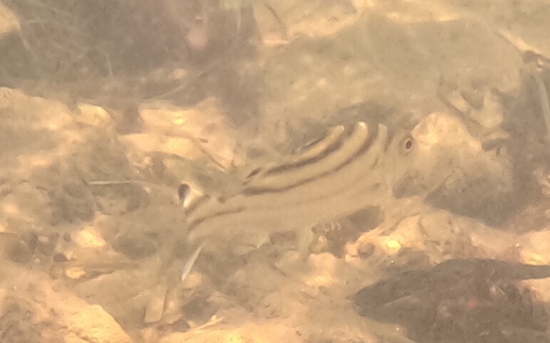
Crescent grunter is an Indo-Pacific euryhaline terapontid, from the Red Sea and East Africa to Samoa, north to southern Japan and south to the Arafura Sea, Australia and Lord Howe Island. It lives over shallow sand, in estuaries and rivers, with adults also in freshwater and juveniles common in sandy intertidal areas and tidal pools; FishBase's recorded depth range is 20–350 m, but adults are mainly shallow. It is catadromous, spawning at sea and migrating into freshwater as juveniles. FishBase gives a maximum of 36 cm total length, a common length of 25 cm standard length and maturity at about 13 cm (range 9–17 cm). IUCN lists it as Least Concern, assessed in 2016.
Reading the spines
The dorsal fin has 11–12 spines and 9–11 soft rays; the anal fin has 3 spines and 7–10 soft rays. The body is oblong and moderately compressed, its greatest depth 2.5–3.2 times in standard length; head length 2.3–2.6 times in standard length; the lower opercular spine extends well beyond the opercular flap; the posttemporal bone is exposed and serrate posteriorly; pectoral fin rays 13–14; gill rakers 6–8 + 13–16, total 19–24; pored lateral-line scales 75–100; horizontal scale rows above the lateral line 13–17; the caudal fin is emarginate. The body is silvery grey with 3–4 dark curved longitudinal bands, stronger in juveniles; the dorsal fin has spines and dark markings. The curved bands, long lower opercular spine and fine lateral-line scales are the practical checks. and are local aliases; the formal name is .
A sand-and-estuary grunter
FishBase's range is the Indo-Pacific: the Red Sea and East Africa to Samoa, north to southern Japan and south to the Arafura Sea, Australia and Lord Howe Island. The country table includes American Samoa, the Andaman and Nicobar Islands, Australia, Bahrain, Bangladesh, Brunei, Cambodia, China, the Comoros, Djibouti, Egypt, Eritrea, Fiji, Hong Kong SAR, India, Indonesia, Iran, Iraq, Israel (introduced), Japan, Jordan, Kenya, North and South Korea, Kuwait, Lord Howe Island, Madagascar, Malaysia, the Maldives, Mauritius, Mayotte, Micronesia, Mozambique, Myanmar, New Caledonia, Oman, Pakistan, Palau, Papua New Guinea, the Philippines, Qatar, Réunion, the Ryukyu Islands, Samoa, Saudi Arabia, Seychelles, Singapore, the Solomon Islands, Somalia, South Africa, Taiwan region, Tanzania, Thailand, Timor-Leste, Tonga, the UAE, Vietnam and Yemen. GBIF's 10,445 records are led by Australia (1,613), Japan (1,463), Mozambique (1,190), Taiwan region (1,049), the Philippines (672), India (608), Indonesia (398), Malaysia (372), South Africa (357), mainland China (348) and Thailand (212). It is found over shallow sandy bottoms near river mouths, enters estuaries and rivers, and juveniles and adults are often in freshwater; adults form loose aggregations, juveniles are common in sandy intertidal areas and tidal pools; it is omnivorous, feeding on fishes, insects, algae and sand-dwelling invertebrates; it spawns at sea and juveniles migrate into freshwater; the male guards and fans the eggs; it produces sound.
The blanks are information
FishBase gives year-round spawning off the southeast coast of India and notes that spawning varies with the monsoon. It lives at 26–29°C and is catchable all year; in Taiwan region, Hong Kong SAR and southern China, late spring to autumn is the main window, with winter fish deeper or inside estuaries. No finer local season table is published, so follow local estuary and coastal temperature. Tide and slack water concentrate food on sand and inside river mouths; dawn, dusk and night also work. It schools, so finding sand structure beats fishing an empty flat.
Where to start looking
The GBIF pattern is Australia, Japan, Mozambique, Taiwan region and the Philippines first. Fish the sand bar, the river-mouth edge and the tidal pool, not the open beach. The source gives no coordinates; local knowledge of channels and sandbars is the real map.
Tackle and baits
Shore casting, light rock fishing and estuary bottom fishing are the standards: small hooks, fine leaders, and prawn, sandworm, fish chunk, bread or plant matter. It is omnivorous, so bread and algae-based bait often work in estuaries; large hooks and heavy leaders cost bites. Small soft plastics, micro-minnows and jigheads can be slow-rolled. Schools compete for food, so a light rig and a natural entry work best. Juveniles are common in tidal pools and should be released.
Eating, handling and the rules
Crescent grunter supports minor commercial fisheries and commercial aquaculture, sold fresh or dried-salted; the flesh is fine, good steamed, braised or in soup. Bleed, gut and ice it promptly; estuary fish can carry a muddy note, which bleeding and clean ice reduce. Ciguatera is mainly a reef-predator issue, so this species is lower risk, but organs should not be eaten in quantity. Rules vary: Taiwan region manages inshore fishing through closed areas, seasons and gear restrictions, and recreational fishing must follow Fisheries Agency and local government notices; Hong Kong SAR's Fisheries Protection Ordinance regulates methods, with no angling or collecting in marine parks and reserves; Southeast Asian states differ widely, with Malaysia, Indonesia, the Philippines and Thailand issuing size and closed-season rules and usually prohibiting take in mangrove and estuary reserves. Check the current local notice.
What the record leaves open
The page is built from FishBase taxonomy, morphology, distribution, environment, biology, reproduction, use and IUCN entries, with the country table for range and GBIF/iNaturalist for occurrence. The 20–350 m depth range is FishBase's record, but the species is mainly shallow; the text says so. Water temperature and local size limits are not standardised. and are local aliases; the formal name remains .
How to catch it
Bottom fishing
Fished with the listed approach, matched to the recorded depth and size.
Lure fishing
Fished with the listed approach, matched to the recorded depth and size.
Where these facts come from
Check these pages before you rely on a size, range or protection status.
- FishBase — Terapon jarbua — FishBase · T2
- GBIF — Terapon jarbua occurrence records — GBIF · T2
- IUCN Red List — Terapon jarbua — IUCN · T1
- Photo record — iNaturalist — iNaturalist · T3
Fish in the same water
These fish live in the same place.

Acoupa weakfish
- Family
- Sciaenidae
- Depth
- 1–20 m
- Season
- Jan, Feb, Mar, Apr, May, Jun, Jul, Aug, Sep, Oct, Nov, Dec

American angler
- Family
- Lophiidae
- Depth
- 0–800 m
- Season
- Mar, Apr, May, Jun

American eel
- Family
- Anguillidae
- Depth
- 0–464 m
- Season
- Jan, Feb, Mar, May, Jun, Jul
Guides for this water
Technique, gear and safety guides that fit Crescent grunter.